Description
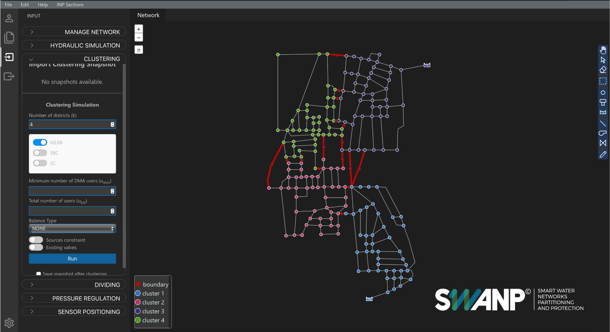
SWANP (Smart Water Network Partitioning and Protection) is an advanced decision-support software designed to perform hydraulic simulations and automatically divide water distribution systems into optimal District Metered Areas (DMAs). It combines graph theory, hydraulic simulation, and multi-objective optimization to identify the best locations for flow meters, valves,, and sensors, all within a GIS-based web platform.
SWANP supports both topological clustering and hydraulic dividing, enabling utilities to design district-based management strategies that enhance operational efficiency, reduce water losses, improve pressure control, and facilitate water quality monitoring.
The tool includes pre-configured performance indicators to compare districts layout alternatives and offers editable reports to support transparent decision-making and regulatory compliance.
Target audience
Owner of the product
Sign in to access this information.Actors, their roles and interactions
SWANP is primarily targeted at:
- Water utility operators
- Hydraulic engineers and consultants
- Municipalities and infrastructure managers
- Research groups and academic institutions
It is particularly useful during:
- Design of water distribution systems or implementation of DMAs in existing WDNs
- Water safety planning, EU innovation projects focusing on smart and sustainable water management and pressure management programs
- WDNs resilience assessment and evaluation of the benefits of implementing DMAs
Unique selling points
- Fully automatic clustering and dividing of water networks
- Integrated placement of flow meters, PRVs, and quality sensors
- Supports Demand-Driven and Pressure-Driven hydraulic simulations
- Web-based GIS interface – no installation required
- Option to georeferenciate the WDNs
- Editable, ready-to-export technical reports
- Validated on real-world networks, including large-scale systems
- Regulatory alignment: supports D.M. 99/1997 (Italy) and EU WSP principles
Technical requirements
Operating environment:
- Web-based application (no installation required)
- Compatible with all major browsers (Chrome, Firefox, Edge)
- User credentials provided upon subscription
Data input:
- EPANET .INP files (network model)
- For clustering and dividing: number of desired clusters/districts to create
- For sensor positioning: number of sensors
Software data
|